Hiking Apps That Help You Plan Routes And Stay Safe Outdoors
Exploring the outdoors has become more accessible than ever, thanks to powerful mobile technology designed specifically for hikers. From detailed topographic maps to real-time weather alerts, modern hiking apps offer tools that help adventurers plan smarter routes and stay safer on the trail. Whether someone is heading out for a short nature walk or a multi-day backcountry expedition, the right app can make a significant difference in preparation and safety.
TLDR: Hiking apps help users plan routes, navigate unfamiliar terrain, and improve outdoor safety with features like offline maps, GPS tracking, and emergency alerts. Many apps also offer weather forecasts, trail reviews, and difficulty ratings. Choosing the right app depends on factors such as terrain, connectivity, and hiking experience. Used correctly, these tools enhance both confidence and preparedness on the trail.
Today’s hikers rely on apps not just for convenience, but for critical safety functions. Paper maps and compasses remain essential backup tools, yet digital solutions provide dynamic, real-time information that traditional navigation tools cannot match. Below is a closer look at how hiking apps help outdoor enthusiasts plan routes efficiently and stay safe in various environments.
How Hiking Apps Improve Route Planning
Table of Contents
Route planning used to involve studying guidebooks and manually plotting waypoints. Now, hikers can access vast databases of pre-mapped trails, complete with elevation profiles, trail conditions, and user reviews. These features help determine whether a trail matches a hiker’s skill level and time constraints.
Key route planning features include:
- Interactive topographic maps: Show elevation changes, terrain types, and landmarks.
- GPS route tracking: Tracks progress in real time and records completed hikes.
- Custom route creation: Allows users to map out personalized trails.
- Distance and elevation data: Estimates time and difficulty.
- User reviews and photos: Offer insights into trail conditions.
By analyzing this data, hikers can confidently choose trails suited to their fitness levels and interests. Many apps also highlight points of interest such as waterfalls, scenic overlooks, wildlife viewing areas, and campsites.

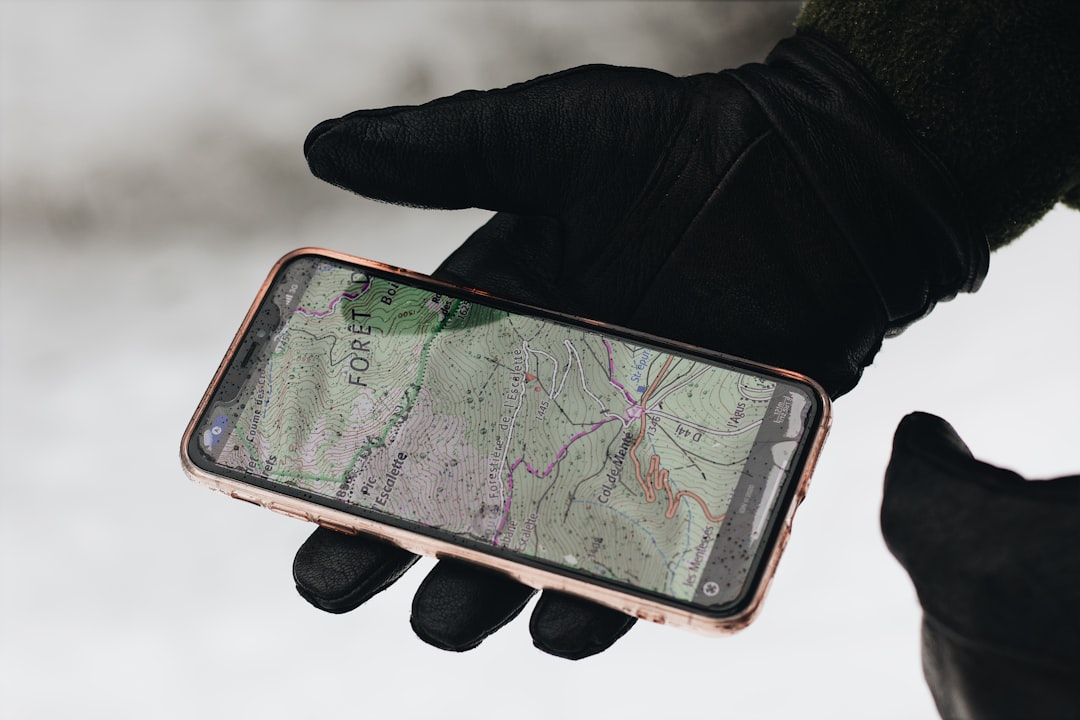
Offline Maps: A Critical Safety Feature
Cell service becomes unreliable or nonexistent in many wilderness areas. For that reason, one of the most important features in a hiking app is the ability to download offline maps. Offline functionality ensures that hikers can access navigation tools even without mobile data.
Offline maps typically allow users to:
- View pre-downloaded trail maps
- Track GPS location without signal
- Mark waypoints such as campsites or hazards
- Access saved route information
This capability significantly reduces the risk of getting lost. Even if a hiker strays from the intended trail, GPS positioning can guide them back to safety.
Weather Forecasts and Environmental Alerts
Weather conditions can change rapidly, especially in mountainous or desert regions. Hiking apps often integrate real-time weather updates, including precipitation forecasts, wind speeds, and temperature fluctuations. Some advanced platforms even offer severe weather alerts.
Monitoring weather directly within the app helps hikers:
- Avoid dangerous storms
- Prepare for temperature drops
- Assess avalanche or wildfire risks
- Adjust trip plans promptly
Planning around environmental conditions improves decision-making and reduces exposure to potentially life-threatening situations.
Emergency and Safety Features
Beyond navigation, safety tools within hiking apps provide additional layers of protection. While they should never replace proper emergency equipment, these features can be lifesaving when used appropriately.
Common safety features include:
- Live location sharing: Allows family or friends to track the hiker’s progress.
- SOS signals: Sends emergency alerts with GPS coordinates.
- Check-in timers: Notifies contacts if the hiker fails to check in at a scheduled time.
- Incident reporting: Enables users to report hazards to other hikers.
Live tracking is particularly valuable for solo hikers. If something goes wrong, emergency responders can locate the individual faster when precise coordinates are available.
Popular Hiking Apps Comparison
There are dozens of hiking apps available, but a few consistently stand out due to comprehensive features and reliability. The following comparison chart highlights some of the most widely used options.
| App | Offline Maps | Route Creation | Live Tracking | Best For |
|---|---|---|---|---|
| AllTrails | Yes (Premium) | Yes | Yes | Beginner to intermediate hikers |
| Gaia GPS | Yes | Advanced tools | Yes | Backcountry and advanced hikers |
| Komoot | Yes | Turn by turn planning | Limited | Multi sport adventurers |
| Hiking Project | Yes | Limited | No | Trail discovery |
Each app serves slightly different needs. Casual hikers may prioritize simplicity and trail reviews, while experienced adventurers might prefer more detailed topographic overlays and backcountry mapping layers.
Choosing the Right Hiking App
Selecting the best hiking app depends on several key factors:
- Skill level: Beginners may appreciate intuitive interfaces and curated trails.
- Location: Remote areas require strong offline capabilities.
- Trip length: Multi day hikes demand advanced navigation tools.
- Device battery life: Some apps consume more power than others.
- Budget: Many apps lock premium features behind subscriptions.
It is also wise for hikers to test an app locally before relying on it in remote regions. Familiarity with settings and tools reduces confusion when it matters most.
Battery Conservation and Backup Strategies
While hiking apps offer powerful support, they rely on battery life. Extended GPS usage can quickly drain smartphones. Therefore, hikers should adopt battery saving strategies such as:
- Switching to airplane mode while using offline maps
- Lowering screen brightness
- Closing background applications
- Carrying a portable power bank
Importantly, digital navigation should complement—not replace—traditional tools. Carrying a physical map, compass, and knowledge of basic navigation skills remains essential.
Using Hiking Apps Responsibly
Technology enhances outdoor adventures, but responsible usage is crucial. Overreliance on digital tools can lead to complacency. Hikers should always:
- Inform someone of their planned route
- Check weather conditions independently
- Download maps in advance
- Understand local regulations and restrictions
Additionally, hikers should respect trail etiquette and environmental conservation principles. Many apps include Leave No Trace guidelines, reinforcing sustainable practices.

The Future of Hiking Technology
Advancements in wearable devices, satellite communication, and augmented reality suggest an exciting future for hiking technology. Some platforms are beginning to integrate satellite messaging for areas without cellular service. Others are experimenting with augmented navigation overlays to guide hikers visually through trails.
As innovation continues, hiking apps will likely become even more precise, interactive, and safety-focused. However, the core purpose remains unchanged: helping people experience nature confidently and responsibly.
Frequently Asked Questions (FAQ)
-
Are hiking apps reliable without cell service?
Yes, provided that offline maps are downloaded in advance. GPS typically works without cellular data, but map access must be saved beforehand. -
Can hiking apps replace a physical map and compass?
No. While highly useful, digital tools can fail due to battery depletion or technical issues. Traditional navigation tools should always serve as backup. -
Do hiking apps work internationally?
Many apps provide global trail databases, though coverage varies by region. Users should confirm map availability before traveling abroad. -
Are free versions sufficient for most hikers?
Free versions often provide basic trail discovery and navigation. However, offline maps and safety features typically require paid subscriptions. -
How accurate is GPS tracking on hiking apps?
GPS accuracy is generally within a few meters under clear skies. Dense forest cover, deep valleys, or severe weather can slightly reduce precision. -
What is the best hiking app for beginners?
Apps with user friendly interfaces, curated trail lists, and strong review systems are often best for beginners. Options like AllTrails are commonly recommended.
Hiking apps have transformed the way outdoor enthusiasts plan, navigate, and stay safe. By combining thoughtful preparation with reliable technology, hikers can confidently explore new trails while minimizing risks. When used responsibly and paired with foundational outdoor skills, these digital tools support richer, safer adventures in the natural world.